 Glossary
 Resources
Resources
Search
The search found 145 results in 0.042 seconds.
Search results
-
River hydromorphology - a primer
(EN) - Onema 2010
The authors introduce us to river hydromorphology and explain the geomorphological characteristics of rivers that create the habitat types on...
Theme : Diagnosing > Documents
-
Water status and the Water Framework Directive: review of assessment methods
(EN) - Onema 2011
This document is a report of two scientific information days followed by two days of discussions focusing on bioindication, organised in France...
Theme : Diagnosing > Documents
-
Diagnosing and restoring aquatic biodiversity
(EN) - Onema 2013
This document recapitulates the knowledge, methods and results presented during the meeting titled “The outlook for managing aquatic...
Theme : Diagnosing > Documents
-
SYRAH-CE project
(FR) - OFB
This page introduces the SYRAH-CE project, whose aim is to evaluate risks for water course physical alterations throught a geographical...
Theme : Diagnosing > Documents
-
The ICE protocol for ecological continuity : Assessing the passage of obstacles by fish
(EN) - Onema 2015
This document presents the issues involved in ecological continuity for fish species, the scientific principles underlying the development of...
Theme : Diagnosing > Documents
-
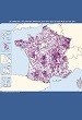
ROE
(FR) - Eaufrance
A database listing the flow barriers present on French territory, combined with national homogeneous information (national code, localisation…). This fact...
Theme : Data and maps
-

Géoportail
(FR) - IGN / BRGM
This website offers maps, aerial photographs and data concerning environment, spatial planning or public services in France.
Theme : Data and maps
-
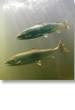
Migratory fish control stations: Breuil en Auge
(FR)
Migratory fish control stations provides informations on the status of fish populations:
Theme : Data and maps
-
HYDRO
(FR) - Eaufrance
A national database for water levels and flows. HYDRO stores the water level measures from about 5 000 measuring stations. It calculates for...
Theme : Data and maps
-

Wetlands maps and inventories
(FR) - Eaufrance
This website, dedicated to wetlands, provides information about the functions and values of wetlands, their regulation... and inventories and...
Theme : Data and maps
Pages
Filter by publication date :
- 2010 (19) Apply 2010 filter
- 2018 (14) Apply 2018 filter
- 2013 (13) Apply 2013 filter
- 2015 (13) Apply 2015 filter
- 2016 (11) Apply 2016 filter
- 2019 (9) Apply 2019 filter
- 2021 (8) Apply 2021 filter
- 2014 (7) Apply 2014 filter
- 2017 (6) Apply 2017 filter
- 2020 (6) Apply 2020 filter
- 2011 (5) Apply 2011 filter
- 2023 (4) Apply 2023 filter
- 2012 (3) Apply 2012 filter
- 2022 (3) Apply 2022 filter
- 2002 (2) Apply 2002 filter
- 2007 (1) Apply 2007 filter
- 2009 (1) Apply 2009 filter